In a world where natural resources are becoming more and more valuable, Fincalista GEO is born with the mission to help you manage those resources in the most efficient, sustainable and profitable way. Our team has years of experience in geographic information systems (GIS) and a deep knowledge of the agroforestry sector to offer geospatial solutions that adapt to any of your needs.
With Fincalista GEO, transforming data into decisions has never been easier. From farm analysis to crop planning to natural risk mitigation, we provide you with the best tools to achieve real solutions presented in a visual way.
What we do?
Suitability of agricultural and forestry crops
Do you have a farm? Are you looking for the crop that will generate the highest yield? We identify the optimal areas for the production of specific crops, considering factors such as climate, soil quality and topography.
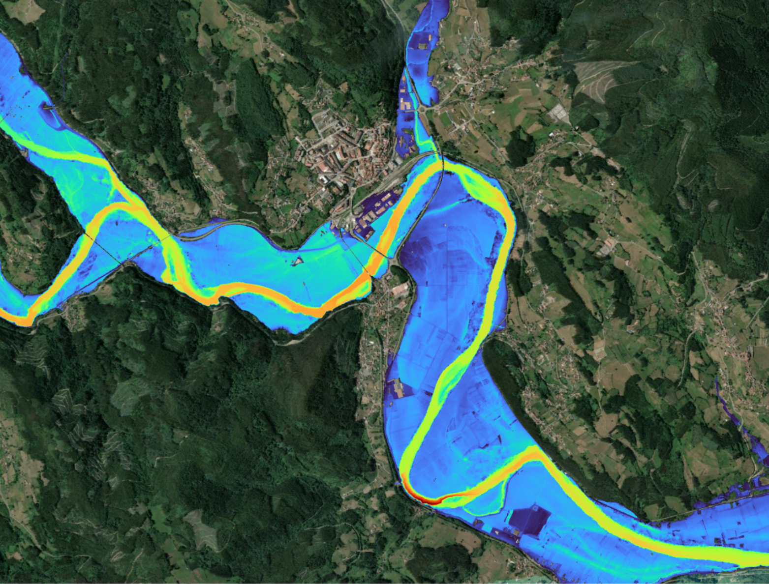
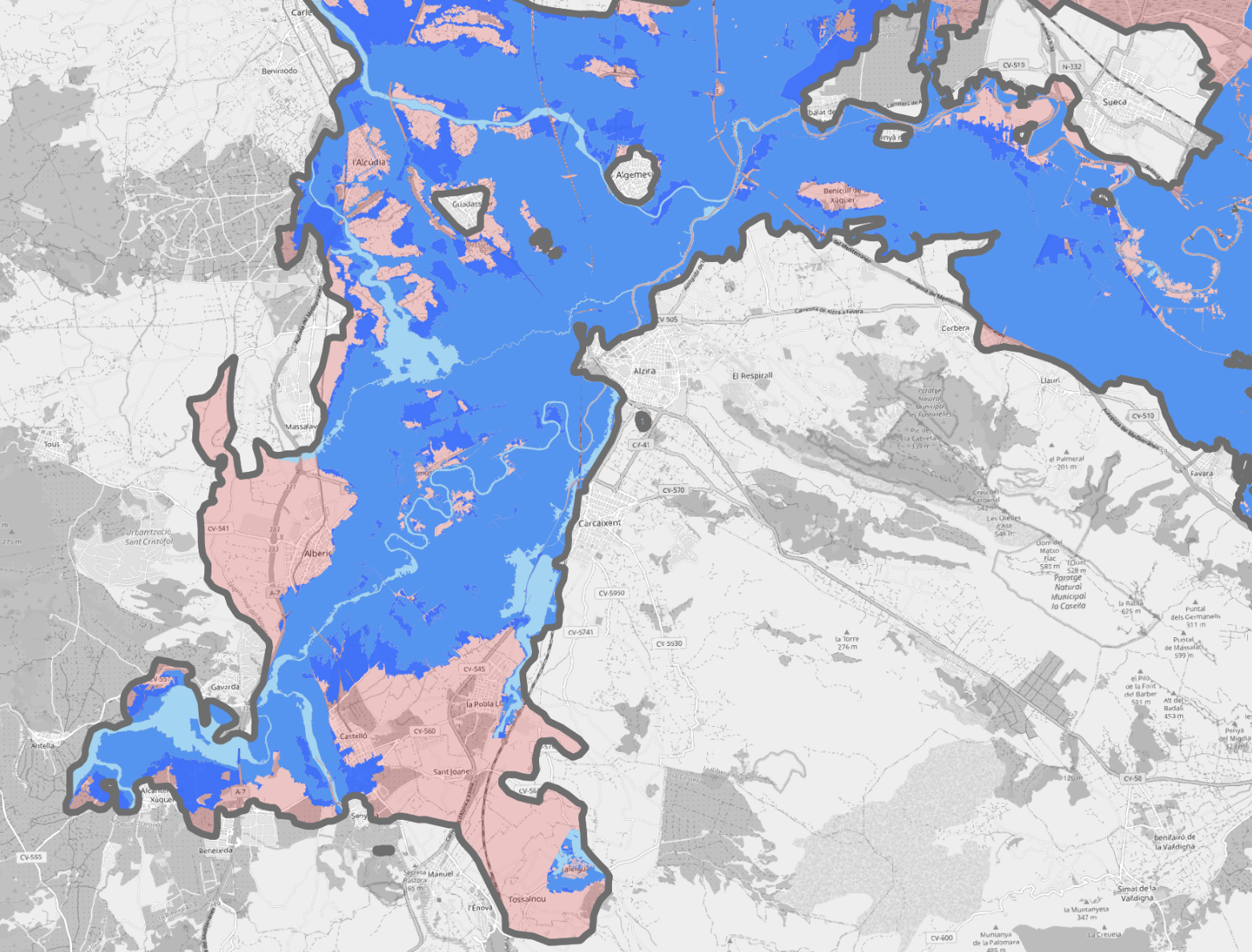
Natural hazard analysis
Anticipate extreme weather phenomena with accurate analysis of areas vulnerable to floods, forest fires and other adverse events, protecting your investments and resources.
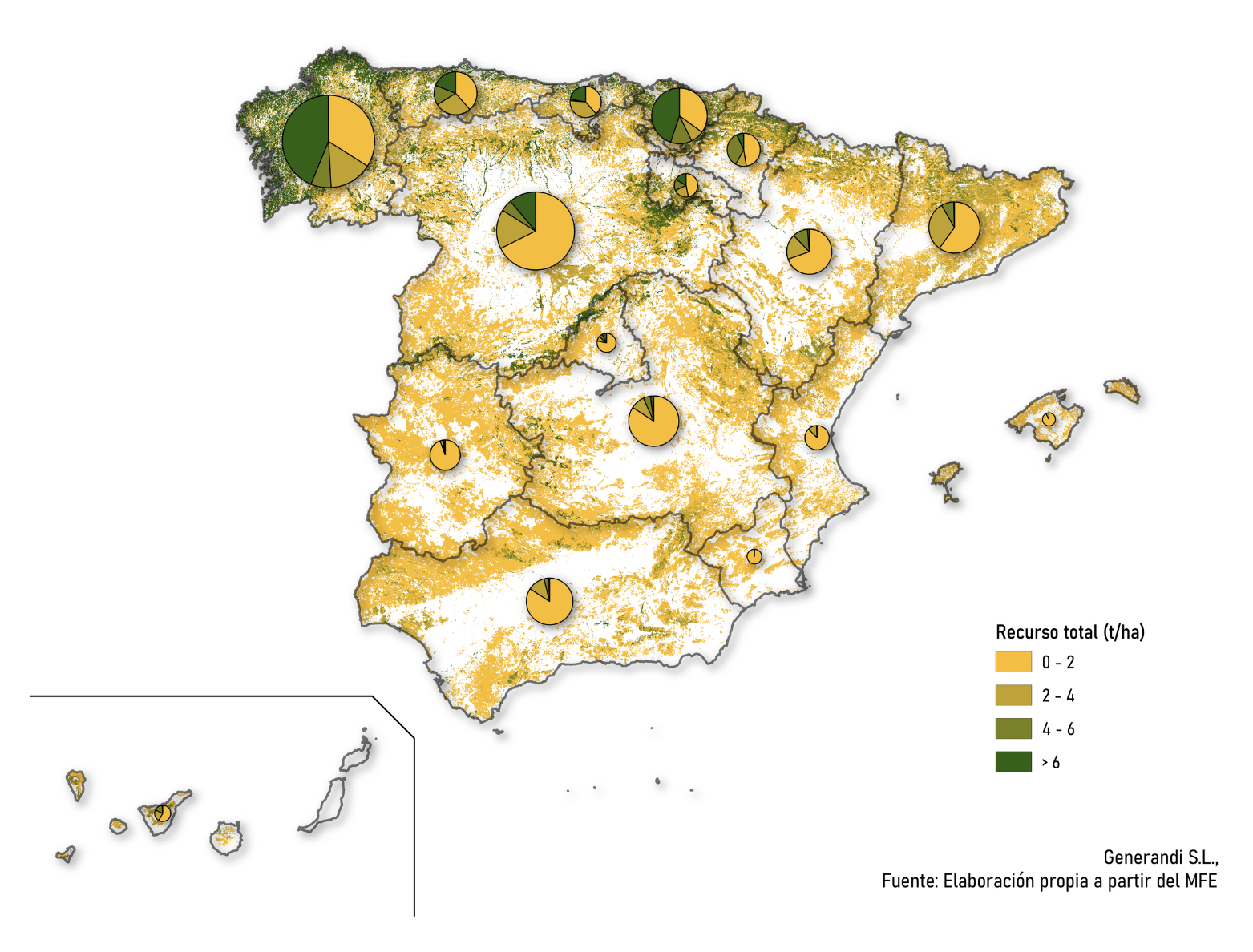
Access to Big Data Agroforestry
Fincalista GEO has been collecting spatial data for years to make it available to anyone. Biomass availability, renewable energy suitability, carbon offset potential, climate, irrigable areas… all the information you need is just a query away.
We understand that every need is unique and has specific challenges. That’s why we tailor our services to suit your particular objectives and needs. Whether you are looking to maximize agricultural production, improve forest management or identify areas of risk, our team works with you to develop solutions that optimize and generate the greatest possible impact.
At Fincalista GEO we have the latest data and master the leading tools in the industry, such as Google Earth Engine, Amazon Web Services, PostGIS and Mapbox. We combine these technologies with our know-how to guarantee accurate and true-to-life results.
Our team is formed by experts in geography, agriculture and forestry, with years of experience in the application of geospatial technologies to the agroforestry sector. Our commitment is always to quality, and to bring the complexity of the natural world to our models.
")